


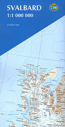
Topografische kaart Svalbard/Spitsbergen 1:1m (2009)
- Normale prijs
- €19,95
- Verkoopprijs
- €19,95
- Normale prijs
- Eenheid prijs
Levertijd is 5 dagen
| ISBN-EAN | 711701 |
| Uitgever | Norwegian Polar Institute |
| Jaar van uitgave | 2009 |
| Formaat | 12x23cm gevouwen; 49x66cm uitgevouwen |
| Taal | Noors-Engels-Duits |
| Levertijd | 5 dagen |
| Soort | Wegenkaarten |
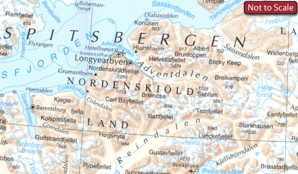
The Svalbard Archipelago: Spitsbergen, Nordaustlandet, Edgeoya and the smaller islands at 1:1,000,000 from the Norsk Polarinstitutt showing the topography, settlements, airfields, etc. The same map is available in two different versions: topographic edition and tourist version.
The map itself is the same in both versions and presets the topography by contours at 200m intervals plus spot heights. The map shows settlements, roads, airfields, lighthouses, radio stations and beacons. Latitude lines are drawn at 1° intervals, with longitude at 3° but with margin ticks at 1°. Bjornoya is included on an inset.
TOPOGRAPHIC VERSION: the map has a bilingual Norwegian/English legend and a glossary of topographic terms, and includes a small map indicating the extent of polar icecap in April and September, plus a grid showing the division of the archipelago into more detailed topographic coverage at 1:100,000.
TOURIST VERSION (this map): there is no map legend or other information included on the topographic version. Instead the map is surrounded by photographs of various aspects of the archipelago.